Local Rides
Rocky Top H-D® is committed to providing the best overall experience possible for our customers. This page is dedicated to giving you some exciting ideas for your next motocycle adventure. Eastern Tennessee is characterized by high mountains and rugged terrain, due to its proximity to the Blue Ridge Mountains. The area offers many elevated views of the surrounding countryside, so sightseeing is always a wonderful addition to any bike ride out here. Many rides will give you the chance to check out the Great Smoky Mountains, which are home to the Tennessee's most popular national park. Tennessee is full of different opportunities to ride, so why not get out and explore with your brand new bike?
Be sure to visit www.ridethesmokies.com for several more rides and updates on group rides that we have scheduled!
-
The Tail of the Dragon
The Tail of the Dragon, also known as Deals Gap or just the Dragon, is considered by many as one of the world's best motorcycling and sports car roads. Located near the Great Smoky Mountains and Cheokee National Forest, this 11 miles strech of road is known well for its over 300 twists and turns! Sounds exciting right? The map image provided will give you an idea of how to ride from our dealership straight to the heart of the trail! Ready to get out and ride? This route caters more to tastes of seasoned and experienced riders, so make sure you are feeling courageous enough to take it on!
-
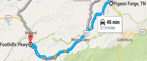
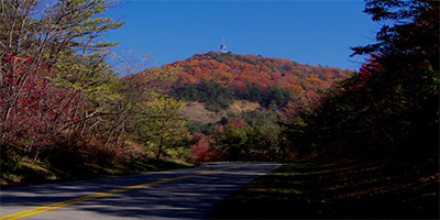
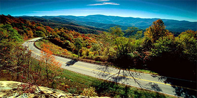
Foothills Parkway
Just slightly southwest of Pigeon Forge is the Foothills Parkway, a beautiful 18 mile long road that is closed off to commercial traffic. It brings a little bit of everything you could want in a good motorcycle ride. The trail offers scenic views, tight curves, and multiple elevation changes to keep you engaged. Some consider it to be less work than the 'Dragon', yet stil just as fun and possibly even more visually appealing!
-
Cherohala Skyway
Designated as a National Scenic Byway, the Cherohala Skyway has been around since 1996. This road travels through the Cherokee National Forest in Tennessee and the Nanthala National Forest in North Carolina. Visiting downtown Tellico Plains is a good choice for starting your next adventure on the Skyway. Located in Southeastern Tennessee, this 2-laned 40+ mile stretch of road offers many elevation changes and different things to see along the way. The road connects Tellico Plains, Tennessee, with Robbinsville, North Carolina. The skyway has several rest area facilities, but there are no gas stations, restaurants or overnight accommodations on the Skyway.
-
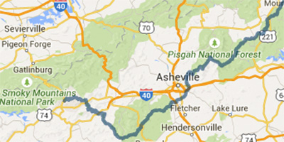
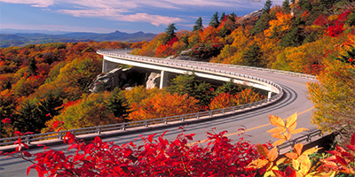
Blue Ridge Parkway
The Blue Ridge Parkway was created when an idea to connect the Shenandoah National Park to the Great Smoky Mountain National Park arose. Completed back in 1983, this road has long been appreciated for its scenic views and many different opportunities for entertainment. As you can see on the map, the trail isn't all that far from Pigeon Forge, so why not get out and try something new with this one?
-
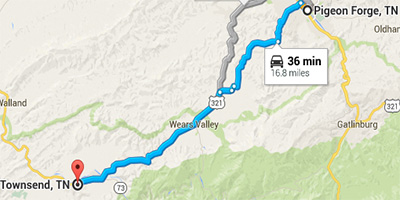
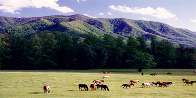
Townsend to Cades Cove
You haven't seen the Great Smoky Mountain National park until you have taken the Cades Cove driving tour! This route offers great views to observe, especially at sunrise and sunset. Keep your eye out for local wildlife, as the area is home to many different animals that could be crossing the road. This area is closest to Townsend Tennessee, so come on out and hit the road in style and see what Cades Cove has to offer!